SITE UNDER CONSTRUCTION – PLACEHOLDER IMAGE ONLY
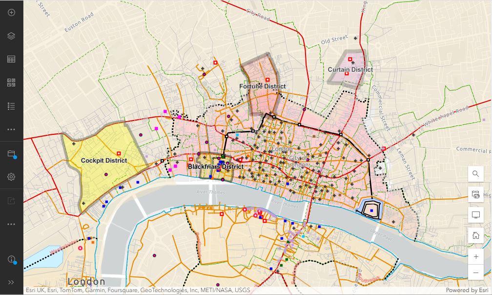
This map is intended to show the location of the Playhouse Districts within the London context – the urban geography of the day – and possible connections and spatial relationships between districts, and potentially between other related features within the districts. The current version of the map only allows zooming and panning around the city, and switching between an historical and a modern base map. When the project is completed, it will allow users to click on features on the map to pop up information about each of them, as well as links to related documents, people, places and sources.